Friday, July 07, 2006

Epilog

Well that’s it for now. I hope that for those of you that have followed this story though the end that I was able to impart to you some of the beauty and wonder that I experienced. I really didn’t take a lot of time doing editing so I apologize for some of the spelling and grammatical errors but it is what it is.
Now that I am back home in California and looking out at the Pacific Ocean from my window I am struck with a sense of peace. I was able to resolve several conflicts in my heart. I was able to spend a nice block of time with only myself to worry about. I met many wonderful people and had a really good time. One day I will return to the Land of the Long White Cloud maybe just for another visit maybe for longer

If you enjoyed the few photos of my trip that I included and would like to see more go to the following link:

http://photos.yahoo.com/coastsidekayaker

Things I would have done differently:
I would have waited and looked around for a van one I arrived
Flown directly into Christchurch
I should have brought a US multi-plug extention so I could have charged many things at once.
I brought more Clothes than I really needed and bike toys didn’t get much use.
I wish I had about 2 more weeks to spend in the South Island.

Things lost:
Gerber folding Knife
Mini Mag flashlight with the cool triple led light
Water bottle with cool sipping top
Smiths Sunglasses

Things Given Away:
Homey the Van
Jet Boil Stove
cool sipping top
several pairs of clipless bike peddles
Several T-shirts
Lots of love and laughter.

The Last Day: April 18th 2006

Andy has to go to the Great Barrier to start his gig with the Outdoor Pursuit Center. He will be there for a couple of weeks. We are going to give another guide a lift to the airport and we all cram into Andy’s Subaru. Everyone says their good byes and off he goes. Angela, Nathan and I drive into the city so I can do some last minute shopping. I take them out to a great Chinese dinner that possibly cost more that their weeks grocery budget. But Angela and the kids have given up time with Andy while he was tramping around with me and I figured that I need to say thanks to them as well. I had arranged to get a bunch of New Zealand wines to take back to my girl and then we head back to the Ranch. I give Paul Hayward a call and arrange to meet them for dinner on this last night. I give them a bottle of wine and have a wonderful time with them. Thanking them again for all their support. I get lost driving there and back. It’s not too bad and I enjoy the streets of the North shore at night in the moon light. I finally return to the Ranch and have a quick word with Angela before I spend my last night in Homey. I fall asleep with my mind swirling with all my adventures. I’m awaken with a gentle rap on the van window as Angela gets me up and we head to the Airport. Both Nathan and Stacy get up to see me off. I am very touched. And as I give them all hugs and say my good byes I can’t help but think how lucky I was and how much this will affect my life.

Packing up to go

Well I have a day or so left in New Zealand. Today is dedicated to getting all my gear back into the two bags I started with. I’ve taken pictures of the Boat for Andy to use for sale. I’ve taken pictures of the Family Smythers. I sign over the Homey Van to Andy as a my way of saying thanks for all the guiding he did. I clean out all my sea shells and sort out the stuff I am going to leave behind. The sky threatens rain but it never comes. I’m ready to leave. It’s either go now or don’t go back at all. I start to think more on all the things that I left undone back in another place on the other side of the world. I have spent much time trying to sort out all the things that weighted me down before I left 50 days ago. I don’t know what will await me when I return. But then life is what it is and I will cope with it as it comes.

Kawau Island – Last adventure

Our last trip will be a day trip around Kawau Island. This trip we will be joined, in part, by Lance and Gregor and his wife whom I meet at CoastBusters. Gregor, who was a member of my pod and a former student of Andy is a Maori bloke and a really fun guy. His wife who is European was also delightful. Lance was Lance which is to say he is a funny guy. It turns out that Lance is a Neil Young fan. I discover this when he spouts out a line from Tonight’s the Night. Only a true Neil fan would know what it was and what its context was (which I am and I did). But I am getting ahead of myself.

We meet up with the rest of our group at Martin’s Bay which is part of a peninsula that makes up Mahurangi Harbour. There are several other kayaking groups going out today. This to me is unusual as I have become accustom to have the water to myself, but I remind myself that this is a three day weekend and that I’ve been paddling mid week most of the time. It different paddling with other people, different pace different objectives. Andy and I split off to look at a Beehive Island. Which is a very small island that looks just like, you guessed it. Well it did until the trees got bigger as Andy informs me. We take a few quick pictures then head over to Kawau to join the rest of the part at the old copper mine. Well all that is really left is the chimney stack. We turn south and take a peak at the back side but we soon discover that the water is a little too rough for our companions so we turn and head north to Mansion House Bay.

Mansion House bay is a favorite stopping spot for boaters and we find the little harbor and beach crowed with pleasure craft. We thread our way through the mob and land up on the beach to have lunch. After that Andy and I head north to begin our circumnavigation and Lance, Gregor and his wife head for the pub at the local.
Andy and I carry on north around to the back side of the island where we hunt for rock gardens to play in and cave to explore. We actually scare some sharks that were basking near the shore. So now we are paddling in shark infested waters! A new element! Not that I haven’t paddled in shark infested waters before, its just that I never had to actually look at the sharks so it made it less scary some how.

Once around the back side we shoot south for Motuketeketa Island and Moturekaraka Island. This we do in the failing light. We have donned our lights and markers. Gee I’m sure glad that my girlfriend bought me this light marker for our Baja trip. It really is coming in handy now! By the time we reach the Islands it’s full on dark. And the waning moon lights up the surface of the water. There are a few boats on the water but they are anchored and hail us to make sure that we are OK. We reach the island and land up to have a light dinner. Then we push off to the final Island in this long strange trip.

Our final destination is Motoroa Island, a Kiwi sanctuary. We land up in the dark and stow the boats high up on the beach. We take off our paddling gear and grap our headlights and head over to the DOC ranger site and Andy talks to the ranger about the best place to find the elusive bird that only come out at night. He gives us some red cellophane to put over our lights to prevent the birds from noticing us and we march out into the bush. We can here them rustling in the bush and finally Andy sees one but by the time I turn to look I can only see a blur heading deeper into the bush. But it’s enough for me. We head back to our boat and make the night crossing back to Martin’s bay and home. It is about 11pm when we return. We left the beach at 10am, returned to the beach at around 11pm and covered 47km. A great finally to a most excellent vacation!

Circumnavigate Waiheke Island. – Day 4

The next morning early I get some sunrise photos but I miss the chance to get a shot of the setting moon. After an early breakfast we pack and launch out before the park ranger gets a chance to ask us if we paid for the camping, which of course we didn’t. Now it’s the long paddle back to Auckland. It’s now Good Friday and a national holiday. There are hundred of boats in the Tamaki Straits making there way to their favorite spots around the Haukier bay. It the first time I have had to deal with boating traffic since coming here and it is a little unnerving. It’s a beautiful day and we and we pass around the back side of Motuihe Island and then land on Brown’s Island. We walk to the top of Brown’s Island and from there we take in the view of Auckland, Rangitoto and Motutapu islands as well as Waikeke. We walk back to the boats and find that our once deserted beach has been invaded by several power boat families and a couple of sail boats. We break out what’s left of our supplies and make ourselves some lunch. Then is a leisurely paddle back to Ferg’s and home. Once we have the boats and gear secured Andy suggests that we take a quick visit to One Tree hill.
One Tree hill holds the memorial for Sir John Campbell who incidentally owned Brown’s Island. Sir John was at one time the mayor of Auckland and is known as “The Father of Auckland”. He donated Brown’s island and One Tree hill where he is now buried. There is a large obelisk. Again it has great view of the surrounding areas. But oddly despite its name there is no TREE on top of the hill! Apparently there have been several trees on top of this peak. The one that gave the hill its name was cut down my European settlers in the 1800’s but one was replanted by Campbell that was cut down my Maori activist in 1999. Now there is this dirt patch where the tree would have been. So much for history, we return to Andy’s place and decompress for a day.

Circumnavigate Waiheke Island. – Day 3


We break camp and turn the corner and head down the southern coast of Wiaheke this is the last stretch that has that remote uninhabited feeling. After we turn the corner again and start heading east the coast line is dotted with bays and little fleets of sailboat and people. Today will be a long paddle. We need to cover about 35 kilometers to reach our next landing site at Rocky Bay. Instead of following the coast we head west and visit a series of islands that will provide us with a bit more interesting scenery. Pakatoa Island is for Sale. That’s right for sale. You get the whole island and all the building there in. Rotoroa Island is a drug and alcohol rehab and is posted no trespassing. So of course we have to land there and have a drink(yo ho ho and a bottle of Monte Gay Rum). On the back side of this island we find a rough rope hang over a cliff. It’s made up of all sorts of things. It makes you think of bed sheets tied up and escapees. We think it’s to allow someone to pass contraband up to some naught resident of clinic. We are about 6 kilometers away from Rocky bay when night falls so we have to cove the distance in the dark. We have all the lights we need and it’s just finding the place in the dark. We land at a small regional park and camp under a large tree on the manicured lawn. We cook our dinner on a park bench. A very different setting from the last two nights.

Wednesday, May 10, 2006

Circumnavigate Waiheke Island. – Day 2


Next morning the wind has dropped and the sky has that “after the storm” clarity. We pack up and launch out heading around to the north side of the island. We set a rock gardening pace and explore every nook and cranny. The northern side of Waiheke is not a populated and we soon find ourselves alone with the raw beauty of this coastline. We stop in at a small bay with golden sands and make breakfast. The sun is well out and it is actually hot. There are a few houses along the cliff tops but the beach is deserted. We tuck into a sandstone cave to get out of the heat. We head off again exploring caves and slots in the comparatively calm water although there is still a ocean swell that keep us on our toe. While Andy and I were checking out a cave one of these larger set comes in and raise the water lever by a meter. I yell up to Andy that a big set is on it way in and he has enough time to start back paddling to keep from being shoved into the cave’s blackness.

We cover about 21 kilometers at this pace as the day starts to draw to a close. The days are growing shorter and it starts getting dark around 6pm.

We had planned on rounding the island and landing at Hooks Bay. But instead we pull in just shy or Thumb point into Ruruwhango bay which is just on the other side of Hooks but on the northern instead of the southern shore. In the failing light Andy spots a cave and we head over.

This cave is an old Maori hunters cave. The front is almost obscured and the Back of the cave is packed with dirt so that its is about 8 ft off the floor. There is an eerie feeling in this cave. People have been eaten in this cave! But it make on great camping spot. There is a helicopter flying overhead. It appears to be dropping water on the trees. Expensive watering if you ask me. We think that it sees us go into the cave entrance as a couple of time we can here it hovering right over us. After it leaves we actually build a fire. There is the first true campfire I’ve had on the North Island. It feels good and Andy and I lounge in the fire’s light and stare out at the night sky. This time we were sure that the tide wouldn’t reach us but all night long small bits of the caves ceiling sprinkled our us and our gear. Being in a tent I didn’t take any notice but poor Andy in his bivy kept waking up and when a small bit of rock would hit him in the face. I know that feeling after my night camped under the cliffs on the Cavalli Islands.

Circumnavigate Waiheke Island. – Day 1


Back at the ranch, Andy and I are gearing up to do an extend paddle. The plan is to paddle to Waiheke Island via Rangitoto then back via Brown’s. Who knew such fun can be had so close to Auckland! There is a little weather blowing through as we set up at Ferg’s. We are backed to the gills. As we clear the sailboats and duck under the pier the weather show up. Over our shoulders you can see the storm engulf downtown Auckland. Sky city disappears in a grey curtain. That curtain is heading out way. But as it turns out it really is a good thing. The winds hit 25 knots and the passage is whipped up. A fantastic following sea. Andy and I are screaming down to Rangitoto. The sounds that a boat makes when it catches the wave! I could hear Andy coming! Knew that he was about to shoot past me. Swoosh. We sailed into Rangitoto and pulled out at the little DOC dock (that’s a joke son your supposed to laugh). We had a quick snack and we took a tour of the Island. Waiheke is only 600 yrs old. As with many volcanic islands its birth was quick. Because of its short history only native plants have evolved on this big block of lava. It is covered with Pohutukawa trees. The Kiwis call them their Christmas tree. In December they bloom all over in bright red flowers. The way that they cling to the rough rocks and cliffs of the coast line impresses me.

After a hour or so we head off to Waiheke. The wind is still our friend and we pull in to the harbor at Matiaria Bay as the sun peaks out around some very dark clouds. We made the crossing in four hours.

Andy has a friend on the island that he wants to see if we can hook up with him. So while I sit and enjoy the sunset Andy trots off on foot to his friend’s house. He comes back in 20 minutes and I have the water boiling so I make up some tea to warm us up. Now we need to find a place to camp We launch out and find a little pocket beach near Whetumataru Point (the southern end of the bay) and we beach up and make camp. As it will be close to the full moon we are wary of the high tide mark so we tie up the boats and we set up as high as we can go. All night we wake up and take a peek at the water level. The tide comes up close but falls short of the boats.

Tuesday, May 02, 2006

Back to Bay of Islands: Aroha Island to Moturoa Island


I am getting to the point that I have to start thinking about where I haven’t’ paddled yet. As I leave Cooper’s Bay I decide that I should do the northern half of the Bay of Islands and drive back to Piahia and then up to a small Kiwi sanctuary known as Aroha Island. Now Aroha is not really an island as there is causeway that connects the island to the mainland but it is enough to keep the Possums and Stoats out and the Kiwi in. I drive onto the island and meet the caretaker of the island which is owned but the Queen Elizabeth II trust. The profits from the camping grounds on the island go to the running of the education center and the general maintenance. Accept for a German Family that have been traveling for months around NZ, I have the place to myself. I find a cozy little place to camp and then get the boat ready to launch. My plan is to paddle this afternoon to the island of Moturoa which is about 15 km away. There are a collection of lava rock islands that run along the east side of Moturoa Island. The winds are at 15 to 20 knots and expected to pick up later in the afternoon. I will have a tail wind going out and a bit of a slog on my return. Oh well them’s the breaks. This is supposed to be a day trip but I am going to try and knock it out in half a day.
The tide is out and there is a storm heading my way. I launch out and start heading into the main part of the Kerikeri Inlet looking over my shoulder to take stock of the landmarks I will need to allow my return. I can see the dark clouds on the horizon just beyond heading my way. I ride the wind waves out to a small group of islands called the Rahui Islands, they are more of a reef that true islands. I look north west to see if I could use the larger island of Motupapa ( Cocked Hat Island) for wind cover on the return trip. I scout the two bays (Doves and Opito) on the northern shore with their moored sailboat for the same reason. Bay hop back along the lee shore, that’s the plan.
After crossing the Kent Passage I reach Moturoa’s western end in little over an hour. So against the wind I figure I should double the time from this point and that leaves me about two hours to circumnavigate Moturoa (which will be about 8 km) and visit the Black Rocks.
I start down the northern side of the island. There is a peninsula / island sticking out of Moturoa’s side. It becomes an island at really high tide but has no name but the charts show a passage between them. It sticks right up out of the water with shear cliffs. I go to the spot where it is nearest the main island and being low tide there is a little land bridge preventing me from taking a short cut through. I follow along the steep cliff walls until I turn the corner of the now peninsula and into the sheltered water of it’s lee. I paddle along the rocky shoreline until I reach the eastern end. I can see out into the south pacific due east and up to Cape Wiwiki to the north. I see the chain of almost black obelisks that are sticking right out of the water about a kilometer away and just as then the storm that has been closing fast hit me. The rain is intense and the water dances wildly from the raindrops. The visibility goes to about 100 meters and I can see the really hard rain coming at me in a grey wall sweeping over the surface of the water. I am half way between the Black rocks and the main island when the first wave hits me. It hasn’t rained this hard since Greymouth on the west coast of the south island. I turn into the storm and realize that I am laughing out loud throwing taunts at the storm. Telling it to do its worst! Me and my big mouth! Just then I hear the Thunder and I know that I have pissed off Poseidon once again. I can just make out the Black Rocks and there head hard to the safety. I slide myself between two of the towers and just bob in the water until the storm passes. I can see on the other side of the rocks that a sail boat race of some sort is going on as a whole line of boats are healing hard over as they passing just east of me heading north. Their decks are a blur of activity and their crews work to manage the changing conditions. Small fishing boats have also taken shelter in the lee of the rocks. They probably think I’m Nuts.
The squall passes almost as suddenly as it appeared. The sky brighten and the sun comes bursting out. The water turns glassy and I take some time to investigate the rocks around me. What a change in the weather. There are no landing spots to be had on the Rocks so I paddle back to Moturoa and land for lunch on the very tip of eastern end. The shore is rocky accept for this pebble beach that cuts over from the west to the south side of the island. It looks as if no one has landed here in quite a while. I collect a bunch of really nice shells and have lunch. After lunch I decide to pickup every bit of garbage that I can find on the beach. Most if not all if it was blown up on the beach and has been sitting there for god knows how long. I fill up the front of my boat with plastic bottles old bits of rope and oddly enough clothes pins. Now the beach is cleaner than when I found it. I back up my lunch stuff and launch. I follow the southern side of the island which is semi protected from the winds but now I have to make an open crossing against the 25 know head wind that is blowing between the island and the mainland. I head into the wind and slog it out until I can reach be lee side of Motupapa Island. Then I head due north to the lee of the shore and Opito bay. I bay hope over to Dove Bay and then I hug the coast line for the remainder of the trip. As the light fails I reach my little campsite and drag my boat up on to the grass. A good day out!
That night I go looking for Kiwi on Aroha but I don’ find any. I guess John Kirk Anderson was right. Kiwi don’t really exist. DOC has some guy with fake Kiwi Feet making tracks for the tourist!

Tuesday, April 25, 2006

To the end of the World -- Cape Reinga


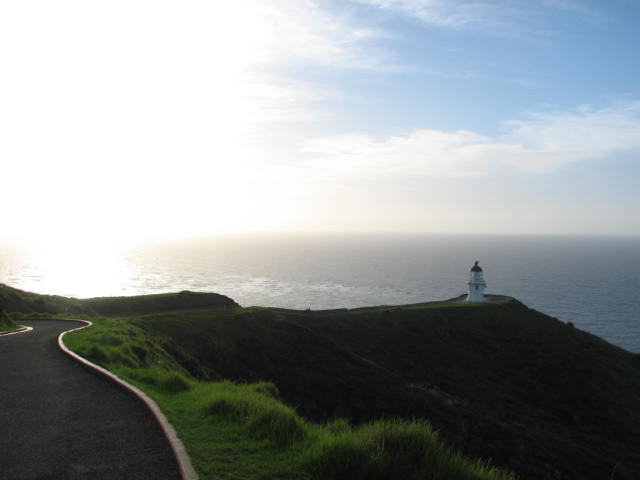
I spend the next morning doing my laundry and getting all my gear stowed and my computer charged at the campsite. I then take a walk to the headland that has the memorial for the Rainbow Warrior which is sunk of the northern end of the islands. After getting enough shots I decide that I need to do something else. It is a really nice here but there are places yet to be seen. So I leave Matauri bay and head NORTH to Cape Reinga. This is the northern most point of New Zealand. It is a 120 k drive and the last 22 k is dirt road. But it was worth it.

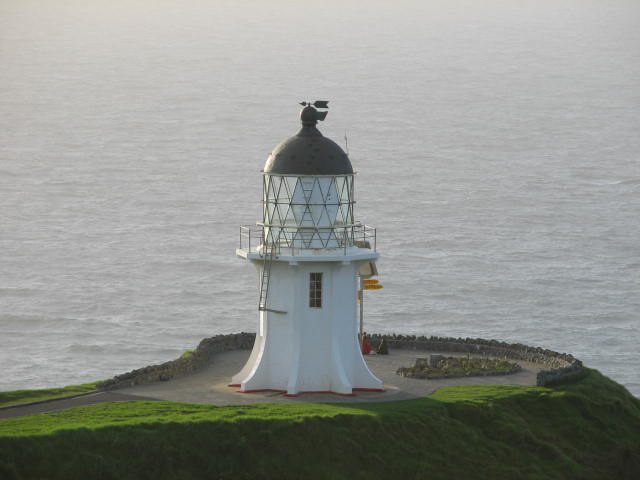
I arrive just before sunset and have time to take pictures of the Lighthouse and the place where the Tasman Sea meets the Pacific Ocean. It is quite exciting. The water is very big and confused. You can see where the swell from one collides with the swell of the other creating great zippers of white spray that shoots 30 feet in the air ( I discovered this later

). I meet a couple of Irish Lads (what is it with me and the Irish?) that are driving a van painted in wild colors that has the word BONGO painted across the front of it. I have seen this van for the last 100 miles. We have taken turns passing one another all the way up highway 1. I ask if they got the van painted like that and they said that they did it themselves. Most of the vans I see with wild paint jobs are from a couple of rental companies that paint all there vans in a unique fashion. They ask me to take there picture and they take mine (one of the few that I have of me on this trip).

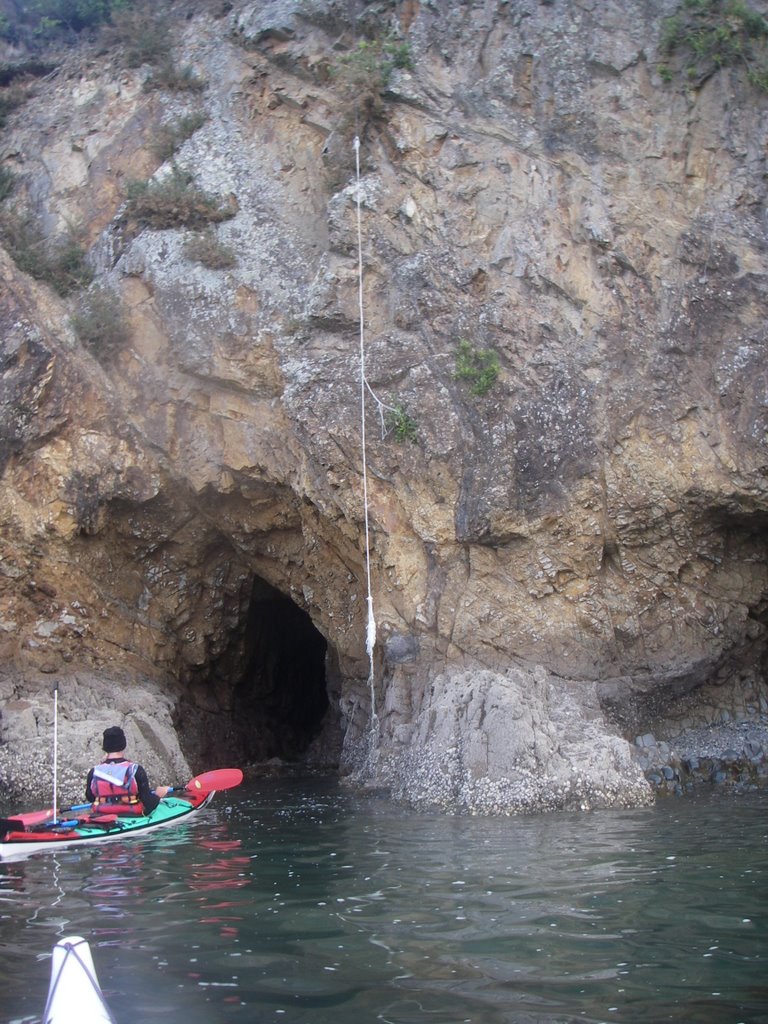
I get some shots of the sun setting but I don’t stay for the sunset as I need to drive another 6 km to get to the campground and possible launching place for tomorrow. The campground is in Tapotupotu Bay and is about 3k west as the crow flies. The bay is semi protected. About the same size waves as you get off of Miramar beach (Half Moon Bay, CA) on a normal day (4-6 ft). I find a nice spot protected from the wind by a tree and still within sight of the water. There are two vehicles at the camp one is the Bongo Van.

My plan is to paddle out of this beach head around the point and paddle to Cape Marie Vann dame which is about 10 km away.

The morning comes and there are light showers. The tide is high and the Bongo has left on it own adventures. After I make my breakfast I walk the beach trying to gage the conditions. This will be a big water paddle alone. I am dealing with my fears about going out alone. I know I can deal with the launch and landing. I’ve done both in bigger conditions than I see before me. I tell my self that I just drove a hundred miles to get here and now I am having reservations. I keep looking for an excuse but finally I realize that I just need to get my shit together and get on the water. I move the van closer to the beach. I talk to a group of guys that has come up on a surfing tour. They tell me that they are going to be here awhile and I tell them of my plans and if I don’t get back in a couple of hours that something is wrong and that they should tell someone. This make me feel a little better. My biggest fear is that I’m alone in water I haven’t paddled in before and it a big water day.

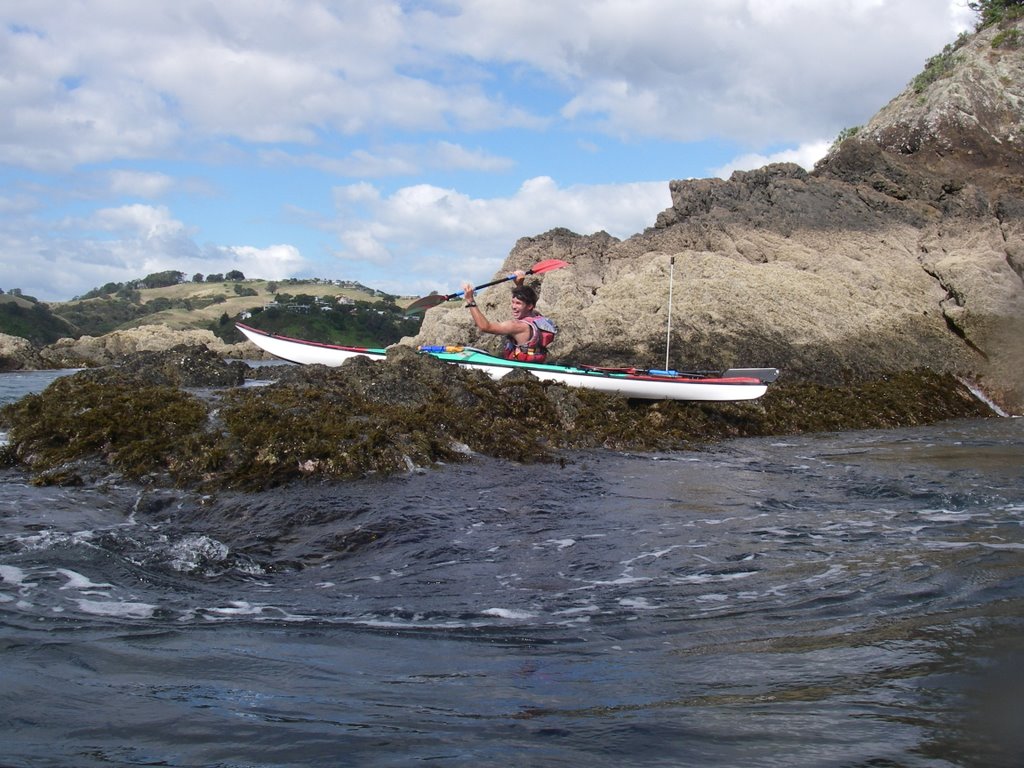
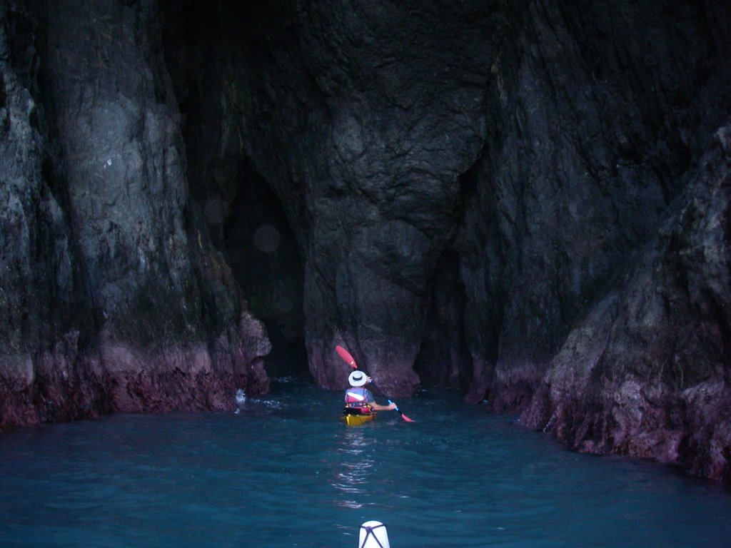
I hop in the boat and launch out into the middle of the bay where the rip is making a nice little hole in the surf. I get about half way through the surf zone when I get hit dead on in the face with a larger set. One of the waves bends me back but I only lose a little ground and recover and paddle hard to get out of the impact zone before the next big one breaks. I succeed and with a few more stokes I’m out. I wave to the surfers who return my greeting and make a left turn to the point.

The swell is the biggest I’ve paddled since coming to the land of the Long White Cloud but it’s by far not the biggest I’ve paddled. I feel comfortable and start making my way to the cape. I take note of the cliffs to make sure I can find the beach on my return not that I think it will be that hard but after misjudging my return location at Lake Taupo I figure it can’t hurt to take a good look. A little further along I notice a little sandy beach that could serve as a secondary landing site if I need one. I watch as the large rollers crash hard against the rough boulders and cliffs that make up most of this coast line. Check all along for places I could land if it became necessary. Well you know what they say, “You can always land you just might not launch”. I get with in sight of the light house and can even make out the joke street sign that point in the directions of various major cities around the world (you see them at many tourist destination). I can even see a few people standing near the retaining wall. I pass the large reef that marks the beginning of the cape. I stay close to the reef staying just outside of the massive mosh pit of white water that it contains. About 200 meters away is where the really scary water lives. This is the Columbia Bank, where the Tasman Sea and the Pacific merge. The two merge in giant zippers of water where the opposing swells meet. Some of these zippers sore 20-30 meters in the air. Between the bank and the reef is a washing machine of chaotic water that oddly enough is the only place that is safe enough. Here the waves come from all directions. They are 3 to 5 meters on average. But they aren’t breaking. White caps but not a real breaking wave. The breaking waves are in the cove behind me.

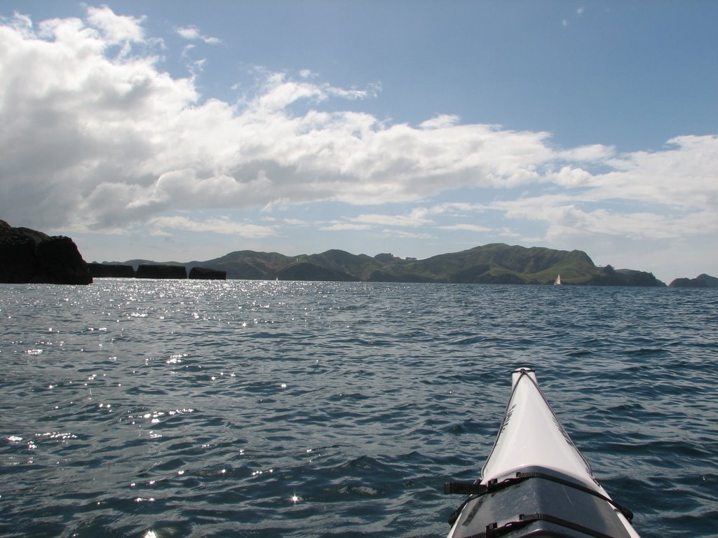
I turn southwest and start to head to Cape Maria van Diemen. I get about a kilometer when I look across at the huge lines of breakers that stretch between Tarawamaomao Point and Motupopao Island which is about 4 km away. They are much bigger and extend much further out to sea than they did last night when I check them out from the point. I sit there and do a little risk management. I look up at the light house and discover that the entire rail is filled with people. I wonder what is going on and then realize they must be looking at me. I decide not to land at Motupopao Island. It’s doable but I feel uncomfortable doing it solo. As I have already accomplished the primary goal in paddling to the Tasman Sea I see no need to continue on to land at the Island. If I had some one else with me I may have given it a shot. I turn the boat a round, no small feat given the size of the swell and its omni-directional nature. I paddle closer to the Bank and try and take some video of the violent merging of the two bodies of water, again no small feat. The horizon is coming and going with each passing wall of water. I start heading back anticipating a fine following sea and a little surf action as my reward. But the conditions are a little too chaotic to allow a good ride.

Once around the corner the seas quite a bit and oddly enough I kind of fall into a daydreamy state where I am on auto pilot. This is abruptly ended by a unexpected wave that cause me to throw a brace and I remember that the waves here are still very big and this is no place to slack off. I guess after dealing with the Banks I had let my guard down. I paddle back toward Tapotupotu Bay and when it comes in sight I notice two very un-nerving things. First the size of the break has doubled. There no longer is a nice little hole in the middle. The second is that the beach is crowed with tourist. I see three large tour busses parked at the picnic area. My first though is “I’m whucked” ( use Maori pronunciation of the WH: hint its F). But I recover quickly and realize that I’ve landed in much bigger conditions safely and that I don’t have to get off this beach by boat! So I continue to paddle to the middle of the bay all the time gauging the swell. It turns out that I just caught a large set and that my initial thoughts were a little exaggerated.

I wait for another big set and follow it in. Unfortunately I miss counted the number of waves in this set and the last wave catches me just before the impact zone. I catch the wave and go screaming toward the beach. Righteous! The wave starts to broach me to the left and I rip along it face toward the reef on the east side of the bay that cause the wave to stand up extra tall. I know that I am going to be folded up into this bad boy and as it breaks on top of me I go into a hard high brace and keep saying to myself “I AM NOT GOING OVER, I AM NOT GOING OVER….”. In my head I see pictures of Greenland kayakers competing in the Walrus Pull where the participant is dragged by a rope and is literally dragged under water ( not a really good descriptions but I have no words to really describe what it looks like). My boat and head are buried under water and after a few moments I lift my head up out of the cloud of white and look at the fast approaching beach. By this time I am back surfing a little with my UNRETRACTABLE rudder pointed toward the sand. The wave has spent most of its power and I am able to sit up a bit (still in my broach landing mode) and get the boat pointing bow first. The boat and I slide gently onto the sand and I hop out and pull her up out of the surf it then I notice 20 or more old people come toward me on the beach. What now? Well as it turns out these folks were with the tour group that was at the light house standing along the rails when I looked up from the water. They were all looking at me down there wondering if I had some sort of death wish or ask if I was trying to commit suicide. They were all full of questions and crowed around me taking picture and eager to show me there photos. They all had them. I asked if any of the folks had large cameras (the ones with the big telescopic lenses ). One of them states “I told you it must have been a bloke, who else would do some thing so dangerous”. I tell them “Oh really” and proceed to tell them about Justine and her friends circumnavigating Tasmania. They take my email and promise to send me copies of their photos. Well I don’t know why my helmet didn’t just split in two my head had gotten so big. I told them that I was a trained professional and that they should do this at home! One of the ladies actually thanked me for thinking that they would actually be up to something like that. I figured that it would be a loss to try and explain that it was a joke. They all head back to their bus and I get out my little cart and haul the boat back up to the van and call it a successful day. After cleaning and loading up I start the long trek south. To date I haven’t received any photos from these folks. Oh well at least they had something interesting to talk about on the way home.

I get as far as Cooper's bay where I pull into a picnic area right on the beach and open up the slider and watch the near full moon dancing on the waves.

Monday, April 24, 2006

The Cavalli Group and Matauri Bay


This is one of the neatest paddles I’ve done while in New Zealand to date and that’s saying some thing. I arrive at Matauri Bay in time to catch the mid day tide. The wind is up and the sky is overcast. I load up the boat and I park Homey at a camp ground so the owner can keep and eye on it while I’m spending the night on the island of Motukawanui, the largest of the group. The closest island in the group, Piraunui, is about 2 km away from the bay. There are about 12 large islands and twice the number of small ones.

Once around the corner of the bay the open channel is exposed to the winds of another Westerly that is blowing through with 10-15 knot winds and 2-4 ft wind waves with the occasional 5 ft swell. But once I get over to the big island and on the east side I am lee of the wind and it is quite calm. The rain has started but it really doesn’t bother me as it did in Tennyson sound and I set out exploring the caves and crevices. I shoot east some more to visit a group of islands one of which has two sea arches that require my passage. I head back to the main island and continue up until I reach the northern end. Its starting to get late and I need to find a place to camp. I take a few minutes to explore the two closest islands to the north but neither has a decent beach. I head back and back track to the first little beach. I select a spot that has a tree growing out of the cliff just over the beach. As it is still raining I set up the tarp and level a spot for the tent. Now these islands are both a bird and animal sanctuary and so the night is filled with all sorts of bird calls. As it’s still raining I make a quick dinner and go to bed early. All night long I hear little rocks tumbling down the hill side and I keep thinking of John Lull’s story about his crunched tent on the beach. But I survive and the rain stops in the middle of the night and it is a beautiful dawn (and I’m not crushed!). I pack up and continue exploring the northern islands and discover a really cool beach on one of the outlying islands. I make a mental note that this would have been a primo camp site, protected and private and head on. It is a much nicer day today and I cruse down the west side of the island to the DOC hut. I discover there that no camping is allowed on the island so I have sinned again.

The Glowworm Caves of Wapui and my return to the Bay of Islands


Andy is working for the next two days and I decide that its time that I hit the road for a while and do some more of the Northlands. On the way I see a sign that saws Waupi Cave Walk 11 km. So I take a little detour down a dirt road and check out these really awesome caves. I take my big light and put on my paddling shoes as I will have to wade in the underground stream to follow the cave back. This cave contains the longest stalactite in NZ. It is also covered in glow worms that look like a galaxy when you turn off your lights. The cave is also covered in slick mud and although the paddling shoes are sure footed on reef they slip and slide on this mud. Although the area out side of the caves seem to be some sort of regional park there is no entry fee and it is all very un-touristy.

Paddling to Tiritiri Matangi Island


The weather take a turn for the better and so Andy and I load up his car ( a Subaru wagon!) and take a drive out to the Whangaparaoa peninsula from where we launched out of Shakespeare beach and paddled out to an island bird sanctuary named Tiritiri Matangi. The crossing is straight forward and we land on a beach in the middle of the island and hike up to the top to the lighthouse. This is the first lighthouse in New Zealand or so I’m told.

This is an island free of foreign pest such as possums, stoats and weasels. So many endangered flightless birds are located here. We get to see many different birds but no kiwis yet. We hike back to our boats and begin to paddle around to the east side of the island. Andy has never paddled there so it will be a new experience for him as well. This side of the island is exposed to the pacific and is rugged and beautiful. We check out the few caves and arches we find and play in the rock gardens. On the crossing back we make a change in plan so that we can have a straight down wind run with a big following sea. We go screaming along and the open water crossing is over in no time flat. Instead of paddling to Army Bay on the north side of Whangaparaoa and then hiking back for the car, we returned to the beach we set out on and hope directly into the car and blast home as we are going to go and visit Matt and his son Billy this evening.

Matt and his family live only a few minutes away from Andy. They have horse property and have just moved here from Britain this year. Matt reminds me of the British actor who plays Turkish in the movie “Snatched”. Right down to the accent and the nearly shaved head. I think that he has taken classes with Andy or Andy has taken him for some kayaking tours. I know that Matt and Billy have been to Tiritiri with Andy. We are there to give a copy of Billy’s rolling lesson with Turner that I digitally recorded on Sunday at Sullivan’s beach. Matt and his wife and two kids packed it in back in Great Britian and moved to New Zealand to start a new life. Matt had a successful business as a plumber back in England but here he has to start all over at the bottom again but he and his family seem happy enough.

Here’s mud in your Eye, Ears, Nose and Throat!


Another cyclone has hit the area and the rain started last night and hasn’t stopped since. So Andy and I load up the bikes and head for a mountain bike park near his home. It raining hard all the way to the park but once we mount up and head into the forest the rain seems to fall away. There are many bikers out today. Real hard core Kiwi’s! The course is a low rolling single track with man made obstacles such as ladders, teeter-totters and jumps. Lucky for me there are bypass runs for the less insane. Andy leads me through the forest he knows so well. Turns out that he broke his neck 6 years ago biking this very park (fell of a elevated path and spent 6 months in a upper body cast). The wet muddy track and the soft chill of the mist that filtered through the canopy of the forest all heighten the experience.

Sailing on the Eye Spy


Next morning we head over to the St whatever marina to catch up with Scott and his wife Helen. They are a fit good looking young couple that seems to be having fun with their lives. Scott and Helen have a 30 ft Young 88 class sloop. They’ve been racing it but today’s sail is going to be a relaxing cruise as they have both had a busy week and want to relax. No problem here. We sail over to Motuihe Island. Motuihe was a quarantined island and then a POW camp in the past, now its home to a few ranchers and numerous pleasure boaters. There is a DOC camp site for those who wish to spend the night. After a brief lunch, Andy Scott and I take a long walk down the beach where Scott played on the sandstone cliffs as a boy. Scott and Andy do some bouldering and climb out on to one of the cliff ledges. We come to some tide pools and I take some pictures of a tiny jelly fish and some even smaller shrimp. On the return trip to Auckland I get a turn at the helm. Back at the dock we bid farewell to our hosts and walk up the doc to discover that we were locked in. We call up Scott and get the pin number to let us out only to discover that Homey isn’t were I left Him. It turns out that I parked him in a tow away zone and his been kidnapped by the evil Towing company and I need to cough up $180 to ransom the old boy back. Again I call Scott and he asked if we are still locked in (SAS- Stupid American Syndrome) offers to give us a lift to the towing company and with a tearful reunion with Homey or sorrowful part with my money ( I’m still trying to decide which) We are back on the road home.

Sunday, April 23, 2006

Surfs Up - Muriwai Beach

After a down day ( I spent the day tidying up the van and washing up my clothes at Andy’s house while Andy leading a group of 8 year olds on a mountain biking trip, yes that’s his job folks ) Andy and I spend the morning running the plastic boat ( a Q-kayak Penguine) that he borrowed back to the shop were he works (Canoe and Kayak). We then pick up a mountain bike for me from Big Foot adventures ( where he also works) and then we pick up Andy’s boat from Scott Waterfield. Scott is the owner/designer/builder of Paddling Perfection Kayaks (makers of high end kayaks for the discriminating tastes). I meet Scott at Paul’s that first night in town oh so long ago. Scott has fixed Andy's boat that Andy busted up on the rocks while surfing and invites us to go sailing with him and his wife this weekend ( more on this trip later folks)

Andy and I head back to his place and swap the Sea kayaks for white water boats and head to the famed surf beach at Muriwai for a little surf session. We hit the waves for about 3 hours. ITs a small day at Muriwai, the waves are only 2 meters tall ( so we only get slightly worked!). After a good bashing we drive a little further up the beach and break out the Mountain bikes go for a little trail run along the coast. We head back tired and happy.


Tuesday, April 18, 2006

Bay of Islands I - Rawhiti and Urupukapuka Island


Andy and I drive south to a small bay in the south end of the BOI. A place called Rawhiti. We launch out into blue skies, Green glassy water and just a hint of a breeze. The water quickly turns to dark aquamarine as we cross over to the island of Urupukapuka, which has and abundance of sea caves and golden sandy beaches. We take our time checking out all the little crags and crannies looking for caves and finding quite a few. This paddleturned out to be one of the highlights of the entire trip!

We also happened upon a basking Seal. Now I’ve seen plenty of seals so I don’t understand why Andy gets so excited and motions for me to get out the camera. It turns out that seal sightings are extremely rare in the BOI. I get out the camera and get some great shots as I pass within inches of the basking Seal. The seal is completely unconcerned with our presents and if anything is simply annoyed that we are disturbing his solitude. He allows himself to drift out the way we came in and leaves us to the cove.

We stop for lunch on this golden beach on a passage that separates Urupukapuka and Okahu passage. The rest of the paddle is a leisurely cruise to complete the circumnavigation no caves but numerous camping sites. We make the return crossing and have the boats packed up and were ready to roll on home. We take turns driving the long grind south to Andy’s house.

Haruru Falls – Attack of the killer possum


We spent the night in the parking lot of the Haruru Falls regional park. Not really a bad place and a lot better than the night before. While making dinner we get visited by several possums. Now for those of you in N. America the possums in New Zealand are very different from the possums found in N.A. They look more like giant squirrels than giant rats. They are also considered a major pest imported from Austriala. Possums kill the kiwi and other indigenous species as well as some of the trees as well. So we take great delight in throwing stones and chasing them off. The next morning as we are leaving we discover that Mark Hutson’s house in right down the street. Mark runs a really cool Kayaking guiding service and I have been trying to hook up with him since I’ve come to NZ. We have breakfast with Mark and his assistant Anders. Mark is about to take the Hawaiian Female Canoe Team for a three day paddle. No kidding. We opted out as we need to get back to Auckland for Andy’s work. Andy and I have another paddle in mind so we didn’t really miss out. Now it off to the Bay of Islands. This is where the Treaty of Waitangi was signed. This document that is said to be the foundation of modern New Zealand. In it the Maori and there land become subjects to the Queen of England.

Whangoroa Harbour and 35 knot winds


Next morning we do a quick pack up and head up to Whangoroa Harbour. When we get to the launch site we find a small clean changing room that we use to cook up breakfast. The weather looks rough and there is a light rain. We set up and paddle north to a cove in the north eastern end. It is quite beautiful. The weather is off and on. We come to a really cool rock formation called the Duke’s nose. Once you look at it it’s obviously a well named feature. The tide is low and we are able to harvest a few oysters. We stop for lunch at a DOC Hut called Lane cottage and get attacked by sand flies. If there are any carnivores in New Zealand then it’s the Sand Fly.

The wind is starting to pick up. We take a downwind tact and head toward the Harbour mouth. The closer we get the bigger the wind swell and the stronger the wind. We shoot out the harbor and try to check out the sea caves that are in the area. The water is just too big to allow us to go inside. By now the wind has really kicked up and we are faced with 35knt head winds with gusts of 45 knt. There is nothing for it but to just put our heads down and do the hard work. We make headway except in the really big gusts. There is no lee to hide and it just a hard couple of kilometers back to our launch site.

Waipoua Forest and the Kauri Trees


With the cyclone still dumping rain Andy and I stock up the car and head north up the West coast heading for the great Waipoura Forest to look at the great Kauri Trees that grow there. They are the largest trees in New Zealand and have a huge trunk that was highly prized for the lumber. They are not large on the order of the Giant Redwoods in California but they are right up there. They are protected now so they can’t be cut down but they find ancient Kauri logs buried in mud that are perfectly preserved and viable. These can be logs that are up to 30,000 years old. Really amazing. The trees also produce a thick gum when they are injured. This is very much like amber in color and texture. We learn all this by stopping at the Kauri Museum (paying $12 admission). Well worth it!

We finally reach Waipoura Forest in the late afternoon and we drive though and stop at the track that takes us to Tane Mahuta “Lord of the Forest”. The largest existing Kauri Tree in New Zealand. We have the place almost to ourselves. I set up the tripod to take a picture of us in front of the tree for scale and as I am running back to the railing that Andy is standing on I leap up to stand next to him and my foot slips on the slimy surface of the railing and I go head long over the rail and almost fall into the delicate root of the tree but The quick hands of Andy manages to grab my shoulder and hold me enough to allow me to grab the railing in a most undignified fashion. But saved I was and we have the picture to boot! We travel on and stop to make dinner under a tarp that we sting up from Homey to a light poll to keep out of the rain. We cook up our dinner and then head a little further east finally stopping in a small town to camp behind the city hall. Andy sleeps in his bivy sack between the van and the back wall. It rains all night long. I expect to hear a knock during the night but Andy is tough as a coffin nail and has a fine sleep.